Safety information
Welsh mountains demand respect. Conditions can change in minutes — even Snowdon in July sees casualties from inadequate kit and unexpected weather.
Carry: waterproofs, walking boots, warm layer, hat & gloves, OS Explorer OL17 (Snowdonia) or OL18 (Harlech & Bala), 1.5 L water, charged phone, head torch. Check the weather at mwis.org.uk on the morning. In an emergency call 999, ask for Police / Mountain Rescue, give your what3words location. Local team: the relevant Mountain Rescue Team.
At a glance
Second-highest Carneddau summit (1,044 m / 3,425 ft) — part of the largest continuous upland plateau in Wales and England. Wild, broad, remote: semi-feral mountain ponies, peregrine falcons, and vast views from Anglesey to Cadair Idris. Classic approach via Pen yr Ole Wen from Ogwen Valley. Navigation skills and experience essential. LL57 3LZ.
About Carnedd Dafydd
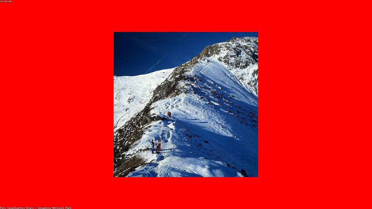
Carnedd Dafydd (1,044 m / 3,425 ft) is the second-highest summit of the Carneddau — the great upland plateau of northern Snowdonia that forms the largest continuous area of ground above 900 metres in Wales and England. Third-highest mountain in Wales after Snowdon (1,085 m) and Carnedd Llewelyn (1,064 m), Carnedd Dafydd has the broad, grassy character of the Carneddau rather than the sharp rocky profiles of Tryfan or the Snowdon ridge. The summit is broad, with a large cairn and views across the whole of north Wales in clear conditions — Anglesey to the north, the Ogwen Valley far below, the Glyderau across the valley, and Snowdon dominating the southern skyline.
The classic approach combines the steep Pen yr Ole Wen ridge (rising directly from Llyn Ogwen) with a broad high ridge walk to Carnedd Dafydd and Carnedd Llewelyn — a serious horseshoe of approximately 12 miles with 1,200 metres of ascent. The Carneddau plateau requires navigation skills: in poor visibility, the featureless high ground can be disorienting without compass and map. The semi-feral Carneddau mountain ponies — around 200 animals, the last such herd in Wales — are sometimes encountered on the plateau.
The Snowdonia Sherpa bus serves the Ogwen Valley in summer from Bethesda and Llanberis. Tryfan (the most spectacular rocky summit in the Ogwen Valley) and the Glyderau are the natural companions on a multi-day Ogwen exploration.
Find it on the map
Frequently asked questions
Carnedd Dafydd stands at 1,044 metres (3,425 ft) — the second-highest summit in the Carneddau range (after Carnedd Llewelyn at 1,064 m) and the third-highest mountain in Wales (after Snowdon at 1,085 m and Carnedd Llewelyn). It is part of the largest continuous area of high ground above 900 metres in England and Wales — the Carneddau plateau, which covers a vast area of high moorland between the Ogwen Valley and the Conway Valley. Unlike the sharp, rocky profiles of Snowdon or Tryfan, Carnedd Dafydd has broad, rounded shoulders and a relatively gently angled summit — the character of the Carneddau is of space and remoteness rather than technical difficulty, though the commitment required for a day on the high plateau should not be underestimated.
The classic approach from the Ogwen Valley combines Pen yr Ole Wen (the steep western ridge rising directly from Llyn Ogwen) with a long ridge walk to Carnedd Dafydd and then Carnedd Llewelyn — a full horseshoe day of 8–12 miles with approximately 1,100 metres of ascent. Pen yr Ole Wen is one of the steepest approaches to any Snowdonia summit; the ridge from Pen yr Ole Wen to Carnedd Dafydd is broad and grassy at high altitude. An alternative approach starts from Bethesda (the slate quarrying town at the head of the Ogwen Valley) via the Gwaun y Gwiail path — a longer but less steep approach across the plateau. Both routes require confident navigation, particularly in poor visibility when the broad plateau can be disorienting. The summit itself has a large cairn and limited shelter.
The Carneddau are the largest mountain range in Snowdonia by area and the most remote-feeling — a high plateau that covers roughly 100 square miles of ground above 600 metres. Unlike the Snowdon massif (concentrated, heavily visited, with clear paths) or the Glyders (rocky, dramatic, with the Ogwen Valley at their base attracting many visitors), the Carneddau feel genuinely wild and empty. The plateau has no summit café, no railway, no cable car, and relatively few visitors compared to Snowdon. The wild Carneddau mountain ponies — a semi-feral herd that grazes the high ground year-round and is one of the last mountain pony herds in Wales — are a unique feature. The summit of Carnedd Dafydd and the adjacent Carnedd Llewelyn give views across the whole of north Wales on clear days, from Anglesey and the Irish Sea in the north to Cadair Idris and the Rhinogs in the south.
The Carneddau Horseshoe is a classic long day walk that traverses the main Carneddau summits in a circuit from the Ogwen Valley — typically: Pen yr Ole Wen (978 m) → Carnedd Dafydd (1,044 m) → Carnedd Llewelyn (1,064 m) → Yr Elen (962 m) → Foel Grach (976 m), returning by the Ffynnon Llugwy reservoir path. The full horseshoe is approximately 12 miles with around 1,200 metres of ascent and takes 7–9 hours for fit walkers. Shorter variations are possible — the Carnedd Dafydd / Carnedd Llewelyn round without Yr Elen and Foel Grach is a widely used option. All variations require navigational confidence, appropriate equipment, and prior mountain experience. This is not a walk for beginners or those without map and compass skills.
The Carneddau have the most distinctive wildlife assemblage of any upland area in north Wales. The Carneddau mountain ponies (a semi-feral herd descended from domestic mountain ponies, now numbering around 200 animals) graze the high plateau year-round — the only herd of semi-feral mountain ponies in Wales still living at high altitude. Peregrine falcons breed on the crags. Ring ouzels (mountain blackbirds) are present in summer on the slopes. In winter, the high ground can have ptarmigan in years of heavy snow (though Snowdonia is at the southern edge of their range and sightings are rare). The Carneddau plateaux are classified as upland heath SSSI, with extensive communities of crowberry, bilberry, and mat grass at high altitude. The Ffynnon Llugwy reservoir on the plateau's eastern flank is a reliable site for red grouse.