Safety information
Welsh mountains demand respect. Conditions can change in minutes — even Snowdon in July sees casualties from inadequate kit and unexpected weather.
Carry: waterproofs, walking boots, warm layer, hat & gloves, OS Explorer OL17 (Snowdonia) or OL18 (Harlech & Bala), 1.5 L water, charged phone, head torch. Check the weather at mwis.org.uk on the morning. In an emergency call 999, ask for Police / Mountain Rescue, give your what3words location. Local team: the relevant Mountain Rescue Team.
At a glance
Yr Eifl (The Rivals) — three coastal peaks on the Llŷn Peninsula, highest at 564 m / 1,850 ft. Outstanding 360-degree views: Snowdon, Cardigan Bay, Anglesey, and Ireland on a clear day. Home to Tre'r Ceiri, a superb Iron Age hillfort. Accessed from Llanaelhaearn (LL54 5AY). 3–5 hrs. Free. Bus 8 from Pwllheli.
About Yr Eifl
Yr Eifl — anglicised as The Rivals — is a group of three rocky peaks that rises abruptly from the north coast of the Llŷn Peninsula, forming one of the most distinctive mountain silhouettes in Wales. The summits are coastal in character: the cliffs fall directly to the Irish Sea on the north and west, while to the east the moorland slopes drop to the small village of Llanaelhaearn. Despite reaching only 564 m at Garn Ganol (the highest of the three tops), the coastal position and relative isolation of Yr Eifl give it a mountain character that exceeds its modest height.
The south-east summit, Tre'r Ceiri (Town of the Giants, 485 m), carries what many consider the finest Iron Age hillfort in Wales — a substantial walled settlement with over 150 stone roundhouse footprints, the walls still standing 2–4 metres high in places. The fort was occupied from approximately 200 BC into the late Roman period and is a Scheduled Ancient Monument. The experience of walking through a 2,000-year-old stone town at nearly 500 m above sea level, with the sea visible on three sides, is unforgettable.
The third summit, Garn Fôr (501 m) to the north-west, shows evidence of 19th-century granite quarrying — the stone from Yr Eifl was used in the construction of Liverpool docks — and its cliffs support seabird colonies including razorbill, guillemot, fulmar, and the rare chough.
Find it on the map
Frequently asked questions
Yr Eifl (sometimes written Yr Eifl or The Rivals — an anglicisation of Y Rivals) comprises three distinct summits: Garn Ganol (564 m / 1,850 ft), the highest, on the north; Garn Fôr (501 m) to the north-west, with remains of old quarrying; and Tre'r Ceiri (485 m) to the south-east, which carries one of the finest Iron Age hillforts in Britain. The three peaks form a distinctive silhouette visible from much of the Llŷn Peninsula and from Cardigan Bay. The name "Rivals" in English is a corruption of Y Reibiellau (a Welsh plural form), not a reference to any competition between summits.
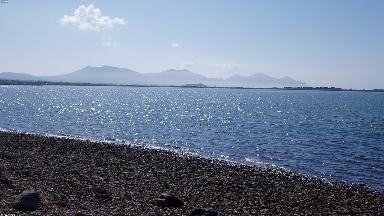
The elevated coastal position of Yr Eifl gives an almost unobstructed 360-degree panorama. To the north: the curve of Caernarfon Bay, Anglesey (Ynys Môn) across the Menai Strait, and — over the island — the mountains of Wicklow in Ireland on a clear day (approximately 60 miles). To the north-east: Snowdon (1,085 m, the highest point in England and Wales) and the Glyderau and Carneddau ranges. To the south: Cardigan Bay arcing south towards Barmouth, with the Rhinogydd and Cadair Idris behind. To the west: Bardsey Island (Ynys Enlli), the island of 20,000 saints, 2 miles off the tip of the Llŷn Peninsula. The combination of mountain and sea vista from Yr Eifl is exceptional — one of the finest viewpoints in North Wales despite the relatively modest height.
The standard approach is from Llanaelhaearn village on the eastern side of the mountain (postcode LL54 5AY, served by Arriva bus 8 from Pwllheli and Caernarfon). From here a track and then path ascends westwards to the ridge connecting the three summits. The circuit of all three peaks takes approximately 3–5 hours and covers around 4–5 miles with 500 metres of ascent. An alternative approach from the north (from the B4417 near Trefor) gives a shorter ascent to the quarrying and Garn Fôr area. The terrain is open moorland on the lower slopes and rocky near the summits — good walking boots and waterproofs are essential.
Tre'r Ceiri (Town of the Giants in Welsh) is the Iron Age hillfort on the south-east summit of Yr Eifl, at 485 m. It is one of the best-preserved prehistoric settlements in Wales — perhaps in Britain — with substantial stone walls still standing 2–4 metres high, enclosing the remains of over 150 stone roundhouses. The site was occupied from approximately 200 BC into the Roman period (AD 400s). It is a Scheduled Ancient Monument managed by Cadw and access is free. Tre'r Ceiri is reached as part of the Yr Eifl mountain circuit (approximately 30 minutes from the standard start at Llanaelhaearn) and deserves dedicated time — it is an extraordinary experience to walk through a 2,000-year-old stone town at nearly 500 m above sea level.
Yes — the sea cliffs on the northern and western flanks of Yr Eifl support important seabird populations. Razorbills, guillemots, and fulmars nest on the cliff ledges, and choughs (the rare red-billed crow, a protected species and symbol of Wales) are regularly seen on the open mountainside. Peregrine falcons nest in the area. The best time for seabirds is April–July during the breeding season. In summer, the slopes also attract ravens, wheatears, and ring ouzels. The combination of coastal cliff and open mountain habitat makes Yr Eifl one of the more diverse wildlife walking destinations on the Llŷn Peninsula.