At a glance
Denbigh is a hillside market town in the Vale of Clwyd dominated by its medieval castle ruin and town walls (Cadw). Birthplace of Henry Morton Stanley. St Marcella's Cathedral and a traditional market town centre below the hilltop fortifications. The Clwydian Range AONB is immediately to the east; the Mynydd Hiraethog moors to the west. A quieter alternative to Ruthin for Vale of Clwyd historical tourism, with fewer visitor facilities but equivalent historical depth.
About Denbigh (Dinbych)
Denbigh occupies a defensible hilltop above the Vale of Clwyd in a position that has been settled since prehistoric times. The medieval castle built by Henry de Lacy from 1282 — one of the lesser-known but architecturally interesting fortifications of the Edwardian conquest — created the planted English borough that became the town. The hilltop settlement has gradually descended to the valley in subsequent centuries, and the medieval hilltop quarter is now largely contained within the castle walls, giving the town a topographically distinct upper and lower character.
The town's most celebrated son is an improbable one. John Rowlands, born in Denbigh in 1841, grew up in the St Asaph workhouse — an institution whose records document a childhood of grinding institutional poverty. He emigrated to America, reinvented himself as Henry Morton Stanley, became a journalist, and in 1871 found Dr David Livingstone at Ujiji on Lake Tanganyika after one of the most extensively reported expeditions in Victorian history. The phrase "Dr Livingstone, I presume" — perhaps apocryphal but irresistibly quotable — became the most famous utterance of a man whose entire life represented an improbable escape from the circumstance of his birth in a Welsh market town workhouse.
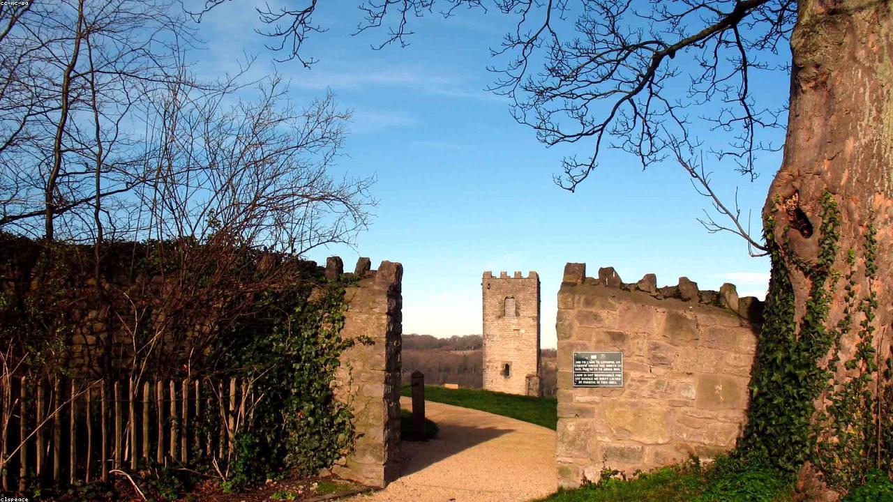
What to see and do
- Denbigh Castle and town walls — medieval fortification with intact gatehouse and partial wall circuit; Cadw admission.
- St Marcella's Cathedral — medieval cathedral church with unusual double nave in the valley below the castle.
- Henry Morton Stanley memorial — birthplace plaque and local historical connection.
- Clwydian Range — hill walking and Offa's Dyke Path, accessible within 15 minutes by car; Moel Famau the principal summit.
- Mynydd Hiraethog (Denbigh Moors) — dark sky moorland plateau west of the town; Llyn Brenig reservoir.
- Market town centre — traditional independent shops and local character.
Getting to Denbigh
By road: A525 from Ruthin (8 miles south) or St Asaph and A55 (7 miles north). A543 west to Bylchau. From Chester: A55 to Junction 27 (St Asaph), A525 south — approximately 40 miles. No railway.
Parking: Town centre car parks on Lenten Pool and Vale Street. The castle is a short steep walk from the town centre car parks.
Find it on the map
Frequently asked questions
Denbigh (<span lang="cy">Dinbych</span>) is known for its medieval castle ruin and town walls — a Cadw site on the hilltop above the modern town, with a largely intact circuit of defensive walls and a substantial gatehouse. The castle was built in the late 13th century by Henry de Lacy following Edward I's conquest and was one of the principal fortresses of northeast Wales. St Marcella's Cathedral in the valley below is the cathedral church of the Diocese of St Asaph. Denbigh was also the birthplace of Henry Morton Stanley (of "Dr Livingstone, I presume" fame).
Henry Morton Stanley, the journalist and explorer who located the missing Dr David Livingstone in central Africa in 1871, was born John Rowlands in Denbigh in 1841. He grew up in the St Asaph workhouse before emigrating to America, where he changed his name. A plaque marks his birthplace in the town, and the Denbigh connection is commemorated locally. The Victorian explorer's origin in a North Wales workhouse is one of those biographical details that the social history of the 19th century makes entirely plausible.
Denbigh has no railway station. The A525 connects to Ruthin (8 miles south) and St Asaph (7 miles north); the A543 connects to Bylchau and the Hiraethog plateau. From the A55: Junction 27 to St Asaph, then A525 south to Denbigh — approximately 8 miles from the A55. From Chester: A55 to St Asaph junction, A525 — approximately 40 miles. Bus services from Rhyl and Ruthin. Parking in the town centre car parks.
Yes, particularly for those interested in medieval fortification and the history of the Edwardian conquest of Wales. The Denbigh Castle gatehouse is an elaborate three-towered structure demonstrating advanced medieval military architecture. The town wall circuit, though ruinous in parts, offers a substantial walk around the hilltop with good views across the Vale of Clwyd. As a Cadw site with a modest admission charge, it is less visited than Conwy or Caernarfon and rewards visitors who appreciate space and context without the infrastructure of the major castles.
Beyond the castle and walls, Denbigh offers: St Hilary's Tower (the remnant of Robert Dudley's unfinished late 16th-century church within the castle walls), the medieval St Marcella's Cathedral in the valley (with its double nave), the market town centre with independent shops, and access to the Clwydian Range AONB on the hills to the east. Denbigh is also a useful base for visiting the Mynydd Hiraethog (Denbigh Moors) to the west — a designated dark sky area with the Llyn Brenig reservoir at its centre.
The Clwydian Range AONB is a line of hills running north-south along the eastern edge of the Vale of Clwyd, forming the natural horizon east of Denbigh. The range contains a series of Iron Age hillforts along its ridge, including Moel Arthur and Penycloddiau. Moel Famau (554 metres) is the highest point and the most popular walking destination. The Offa's Dyke Path National Trail follows the ridge. The hills are accessible within 15 minutes by car from Denbigh.