At a glance
Thomas Telford's 1805 cast-iron aqueduct carries the Llangollen Canal 38 metres above the River Dee — a UNESCO World Heritage Site and still in active use. Free to walk the towpath; canal boat trips from ~£12. The unrailed west edge of the trough is genuinely vertiginous.
About Pontcysyllte Aqueduct
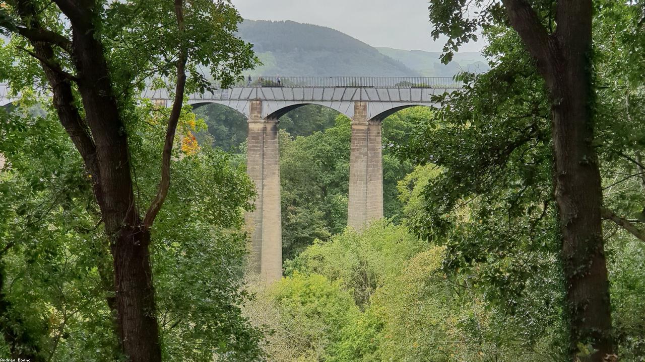
Pontcysyllte Aqueduct is one of the great engineering achievements of the early Industrial Revolution — a 307-metre cast-iron trough carrying the Llangollen Canal 38 metres above the River Dee in the Vale of Llangollen. Designed by Thomas Telford with William Jessop and completed in 1805 after ten years of construction, it was the longest and highest navigable aqueduct in the world at the time.
The structure rests on 18 hollow masonry piers, each tapering slightly towards the top to reduce weight while maintaining the visual effect of solidity. The cast-iron trough — Telford's key innovation — carries water only 1.6 metres deep, with a towpath along the east side protected by a metal railing. The west side of the trough has no railing whatsoever — boats on the outside edge have nothing between them and a 38-metre drop. This is not a design oversight but a deliberate engineering choice that reduces weight and remains entirely functional for its purpose.
The aqueduct was inscribed as a UNESCO World Heritage Site in 2009 as part of the Pontcysyllte Aqueduct and Canal — 11 miles of the Llangollen Canal from the aqueduct east to the Horseshoe Falls weir at Llantysilio. It remains in active use as a leisure waterway, with narrowboats crossing the structure daily during the canal season.
Visiting the aqueduct
Walking the towpath
Park at Trevor Basin (LL20 7TY) on the north bank — free car park. The towpath approach from the basin car park to the aqueduct is a 5-minute level walk. Walk the full 307 metres across and back — 30–45 minutes total. The railing on the towpath side provides security; the drop beyond the trough edge is fully visible and gives appropriate drama.
Boat trips
Several operators at Trevor Basin offer narrowboat excursions across the aqueduct — approximately 1.5–2 hours including a crossing. This is the recommended way to experience the structure properly: sitting on the outside of a narrowboat with nothing between you and the Dee Valley below is unforgettable. Book in advance for summer weekends.
Combining with Chirk Castle
Chirk Castle (National Trust) is 2 miles from the aqueduct — an excellent same-day combination. Walk the aqueduct in the morning and visit the castle in the afternoon, or take a morning trip boat and visit Chirk after lunch.
Find it on the map
Frequently asked questions
Yes. The Pontcysyllte Aqueduct and Canal was inscribed as a UNESCO World Heritage Site in 2009, recognised as an outstanding example of innovative civil engineering during the early Industrial Revolution. The World Heritage Site covers 11 miles of the Llangollen Canal from the aqueduct to the Horseshoe Falls at Llantysilio.
The aqueduct carries the Llangollen Canal 38 metres (126 feet) above the River Dee. It is 307 metres long and rests on 18 hollow masonry piers, each tapering towards the top. On the towpath side there is a metal railing; on the canal side there is no railing — the iron trough is simply the edge of the water. It can feel considerably more exposed than 38 metres sounds.
Yes — walking the towpath across the aqueduct is completely free and available at all times. The towpath (on the east side of the trough) has a metal railing beside it. The walk across and back takes about 30–45 minutes and is one of the great free experiences in North Wales. People with vertigo should be aware that the west (canal) side has a sheer 38 m drop with no barrier.
Yes — boat trips depart from Trevor Basin (LL20 7TY) and include a crossing of the aqueduct. Crossing by narrowboat is the most dramatic way to experience the structure — particularly from the unrailed (outside) edge of the boat. Several operators offer trip boat excursions from around £12–15 per adult. Private hire narrowboats can also be arranged for multi-day canal holidays.
The aqueduct was designed by engineer Thomas Telford, working with William Jessop, and was constructed between 1795 and 1805 at a cost of £47,018. Telford's innovative use of cast-iron troughs (rather than masonry lined with clay puddle) allowed him to create a much lighter and taller structure than had previously been possible. It was the longest and highest aqueduct in the world when completed.
Yes, with supervision. Children enjoy the drama of walking across the high towpath, and the boat trips are particularly exciting. Younger children should be kept away from the unrailed canal edge. The Trevor Basin area has good picnic spots, canal boat viewing and a visitor centre. Combining with Chirk Castle (2 miles) makes for a full family day out.